Wrong records mean inflated bills. We put both right.
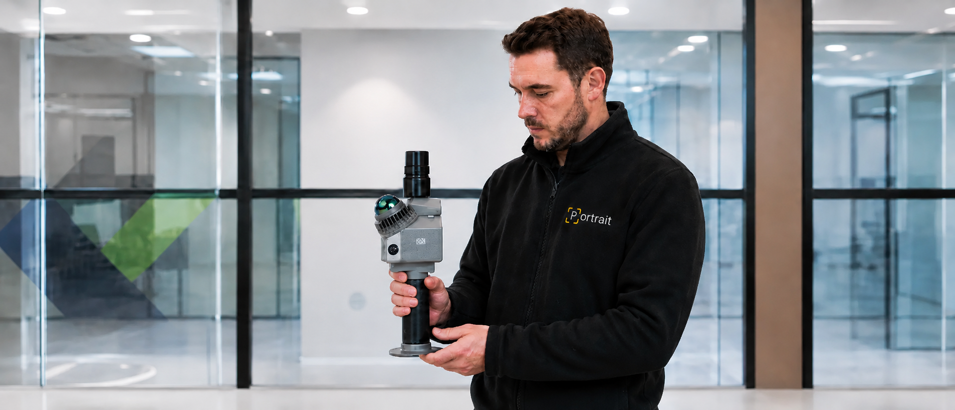
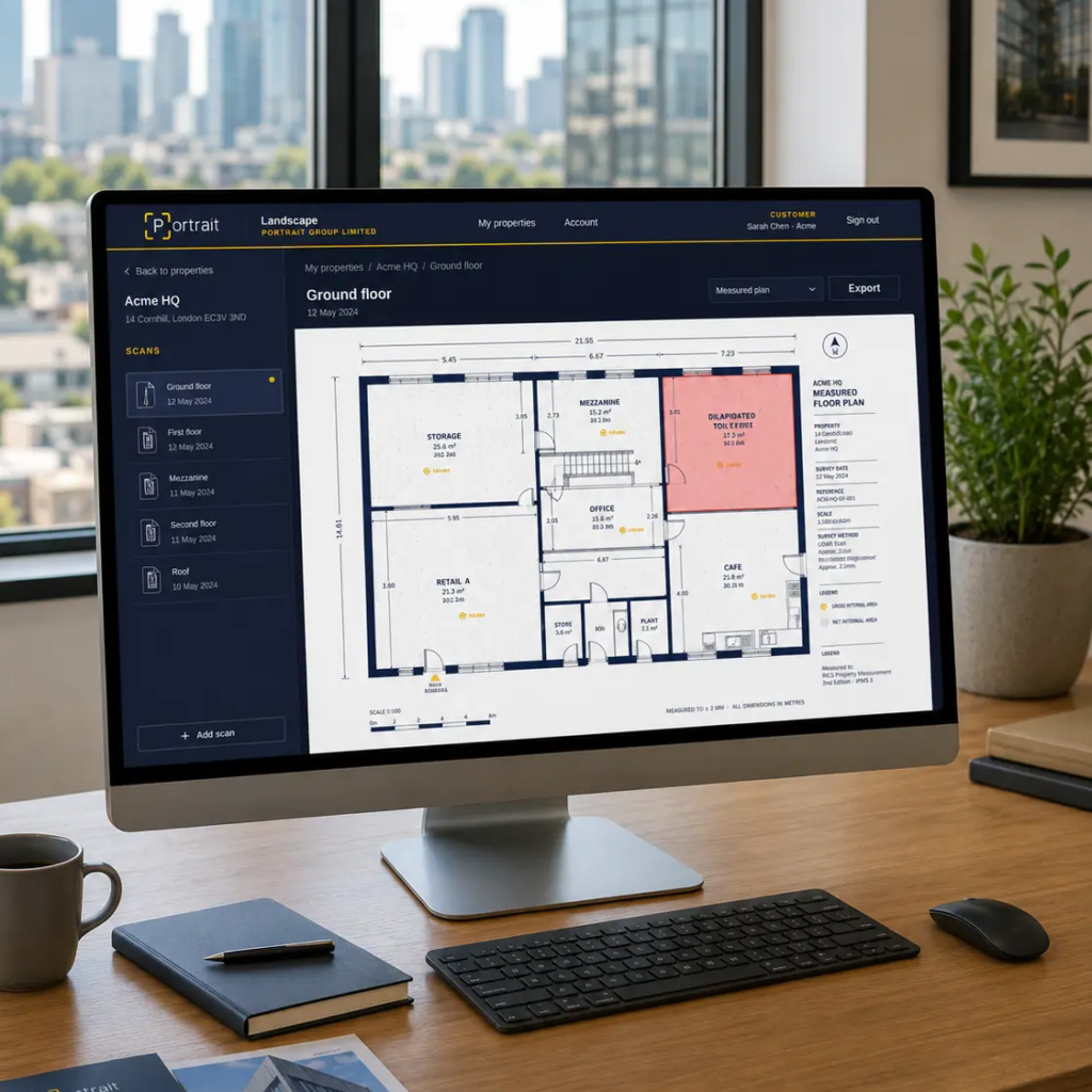
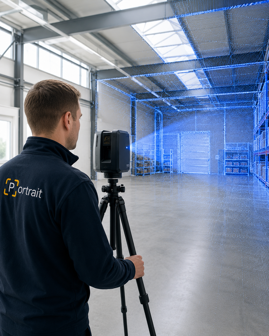
Portrait scans your buildings with LiDAR, capturing measurements and detail traditional surveys miss. Each scan becomes a 3D digital twin that anchors our evidence packs. We check that record against your business rates, drainage charges and insurance data — and where others find no grounds to act, precise measurement and contextual analysis often does. When the records are wrong, we correct them, challenge the charge and recover what you’ve overpaid.
Search your address below for a free, instant check — no forms, no commitment. Thousands of UK businesses are sitting on the wrong rateable value. Find out in seconds if yours is one of them.
Measured, not assumed
Floor areas and volumes captured by LiDAR to RICS measurement standards.
Checked against the VOA
Rateable values and classifications compared line by line with the official record.
Evidence with every case
Each challenge or correction is submitted with the measured data behind it.
No reduction, no fee
Qualifying reviews carry no upfront cost. The fee follows the saving, on signed terms.
Who we work with
Different desks, the same question: is this bill right?
The evidence we produce serves whoever carries the property cost, from a single premises to a national portfolio.
Project Managers
Reliable measured data for design, planning and cost control on live schemes.
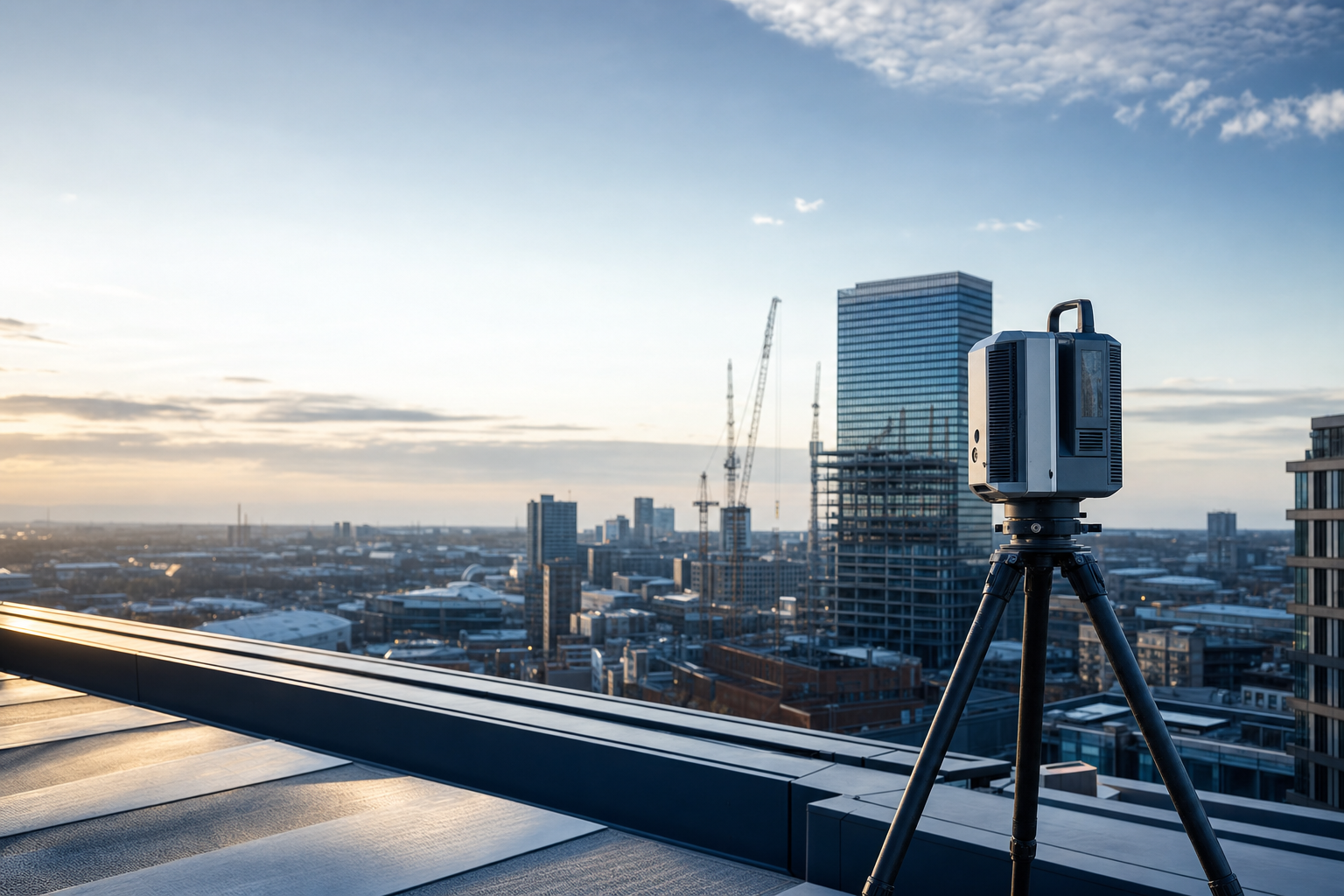
A Portrait surveyor captures your property with LiDAR. The output is a measured record of floor areas, heights and volumes aligned to RICS standards, and it underpins every later step.
Full internal and external capture in a single visit
Areas and volumes traceable back to the scan
A digital record you keep, whatever happens next
Compare the records with the measured facts
Your charges rest on data held by the VOA, the water company and your insurer. We set each record against the survey and list every discrepancy in plain terms, with its likely cost.
VOA rateable value and property classification
Surface water and highways drainage billing
Policy schedules, sums insured and declared values
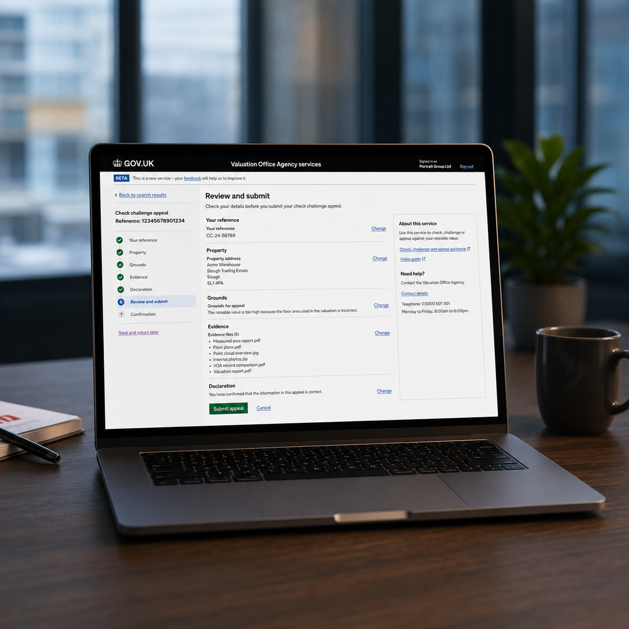
Put the case, with the evidence attached
Where a record is wrong we take it up with the body that holds it: a rates check and challenge, a billing dispute, a mid-term adjustment. You approve the case before anything is submitted.
Prepared and submitted by Portrait on your behalf
Every claim tied to a measured, documented fact
Progress visible to you at each stage
Corrections become refunds and lower bills
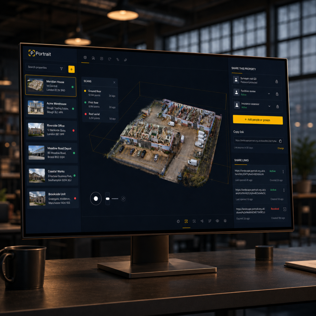
Successful challenges produce backdated refunds, reduced ongoing charges and accurate cover. The measured data and every document from the case stay available to you in Landscape.
The full service line in one place, including digital deliverable packs quoted per property.
Portrait platforms
Landscape and Perspective
Two products built around the same idea: decisions about property costs should sit on measured, traceable data.
Landscape
The secure client portal for measured building evidence. Scans, point clouds, digital twins and case documents in one workspace, viewable in the browser and shareable under your control.
Business rates research built on VOA data, comparable evidence and scheme analytics. Screen one property or a whole portfolio for grounds to reduce, before a case is ever opened.
Accountants, agents and advisers refer clients whose property costs deserve a check. We run the case and report back; you are paid for the introduction.
Organisations responsible for many buildings partner with Portrait for estate-wide measured evidence, reduction reviews and portfolio visibility in Landscape.
Rateable values, drainage tariffs and insurance schedules behave differently by property type. We work in the detail of each.
Education
Schools, trusts, universities and student accommodation.
Office & Business
Occupiers, landlords and serviced workspace.
Industrial & Logistics
Warehousing, manufacturing and distribution.
Retail & Hospitality
Shops, hotels, pubs, restaurants and venues.
Public Sector
Councils, NHS and public estates.
Automotive
Dealerships, workshops and compounds.
Multi-Site Management
Franchises, groups and portfolios reviewed to one method.
Check your business rates in seconds
Search your property below for a free, instant read on whether your rateable value looks too high — no forms, no commitment. If there is a saving to pursue, we will tell you.